5.1 Roads
Daniel Paranayba / ISA, 2017.
Road construction promotes the development of markets and of some societies, also, encourages unplanned land occupation, promotes socio-environmental change and generates environmental pollution. For Amazonia – with its extensive forest coverage, a vocation for conservation and a wide river transport network – other transport and development models should be promoted that support the conservation and sustainable use of the natural environment, that safeguard indigenous cultures and their rights, and that is based on concepts of equality and equity.
El mapa esta cargando...
MAP: ROADS IN AMAZONIA
Although a highly important variable for evaluating regional impacts, the relevant information is deficient in terms both of spatial scale and the individual features of roads. In the present report, RAISG has used the best available data for each country, building an information layer with more than 96,000 km of terrestrial road networks. Roads are classified into paved, unpaved, and planned. Trails or service roads are not considered.

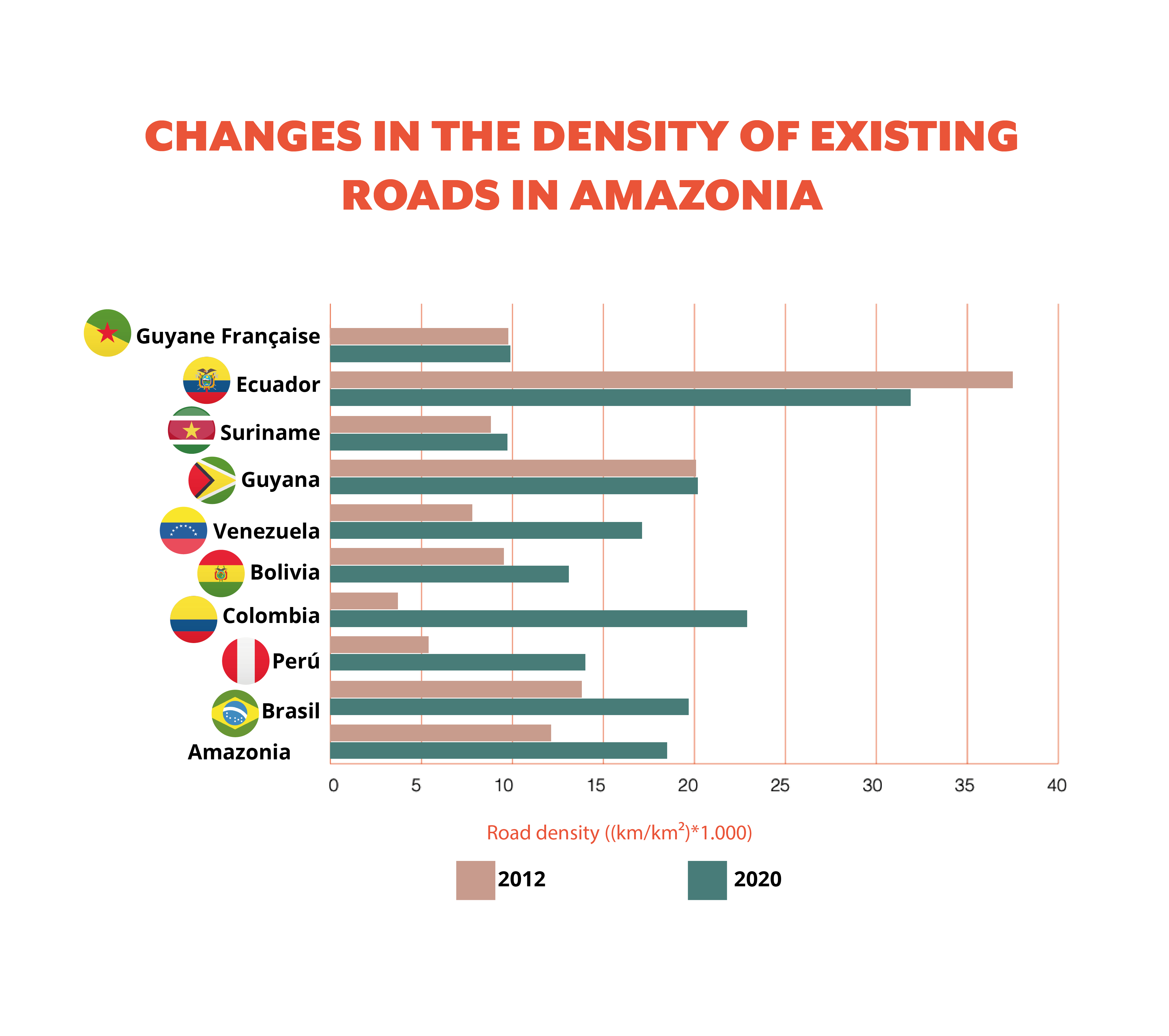
Road density in Amazonia increased 51% between 2012 and 2020, from 12.4 km per km2 to 18.7 km per km². The countries that saw the greatest expansion were Colombia, Perú, and Venezuela. In the case of paved roads, there was an explosion in road density during this period of 110%, going from 4.1 km per km2 to 8.6 km per km². Perú, Suriname, and Brasil were the main participants in this expansion. Brasil’s paved road network grew from 21,000 km in 2012 to 46,000 km.
Multiple authors have established that, in the Amazon region, roads have an impact from 5 to 50 km on both sides of its route. Considering an affected area of 40 km on both sides for roads and 20 km for railways, our analysis concludes that road infrastructure has disturbed 4.6 million km2 of Amazonia, equivalent to 55% of its total area, impacting biological diversity and the human populations living there.
Multiple authors have established that, in the Amazon region, roads have an impact from 5 to 50 km on both sides of its route. Considering an affected area of 40 km on both sides for roads and 20 km for railways, our analysis concludes that road infrastructure has disturbed 4.6 million km2 of Amazonia, equivalent to 55% of its total area, impacting biological diversity and the human populations living there.