
3. Amazonia
Beto Ricardo/ISA, 2008.
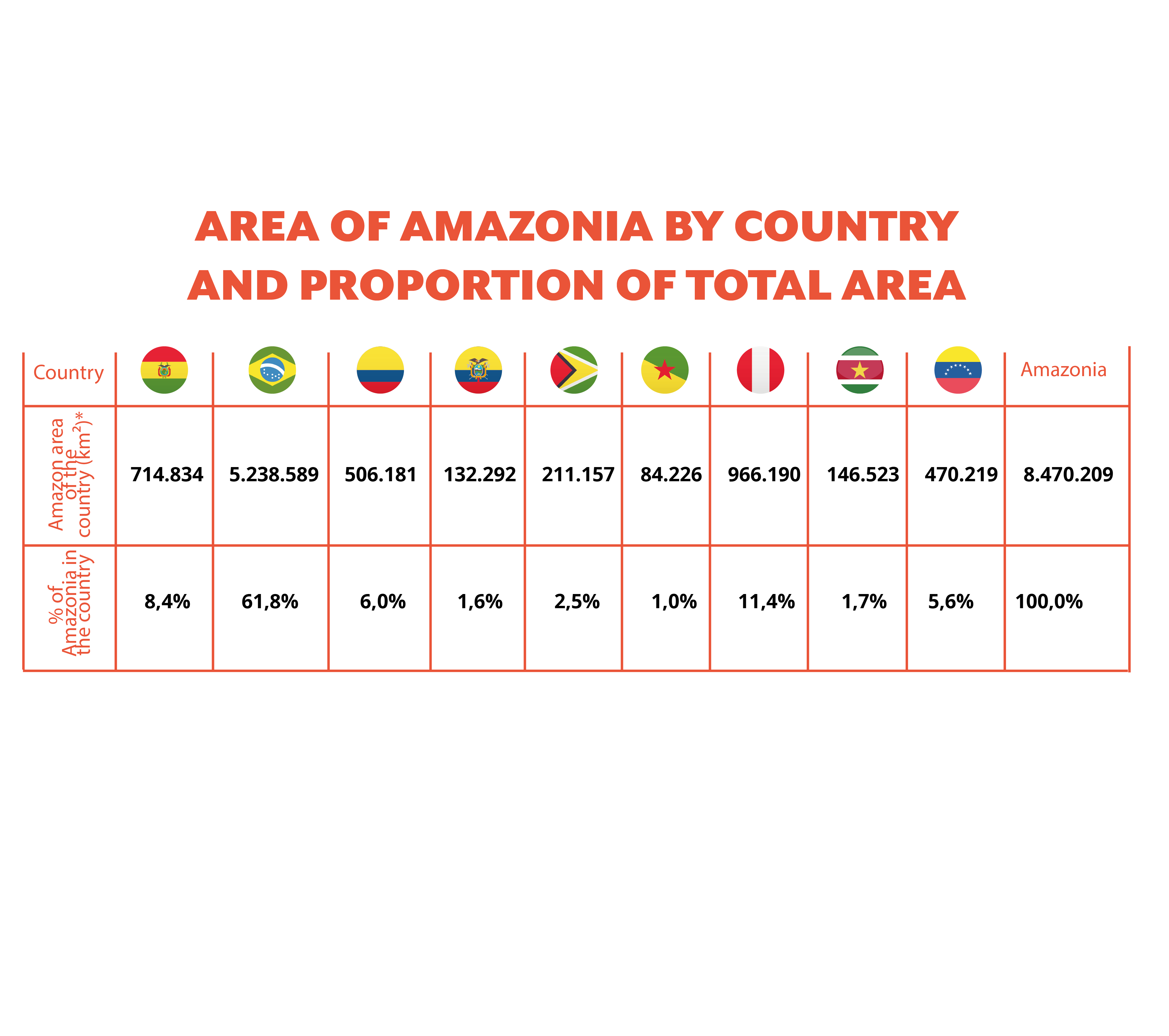
The Amazon is understood as the set of national Amazon regions located in Bolivia, Brazil, Colombia, Ecuador, Guyana, Guyane Française, Peru, Suriname and Venezuela. Even though Suriname, Guyana and French Guiana do not belong to the Amazon River basin, they are covered by similar forests and are therefore included.
These are the figures that correspond to the analysis:
Area: 8.470.209 Km²
Basin: (Amazonas, Araguaia-Tocantins y Marajo Rivers) - 6.925.918 Km²
Basin: (Amazonas, Araguaia-Tocantins y Marajo Rivers) - 6.925.918 Km²
El mapa esta cargando...
Map: Boundaries of Amazonia and their multiple criteria
Amazonia is fundamental to strategies for the conservation of global biodiversity. Scientific evidence suggests that Amazonia currently contains the most extensive tropical forest in the world, a great diversity of ecosystems, a high number of species from different biological kingdoms, many of them exclusive to this region.
El mapa esta cargando...
Map: Vegetation types in Amazonia
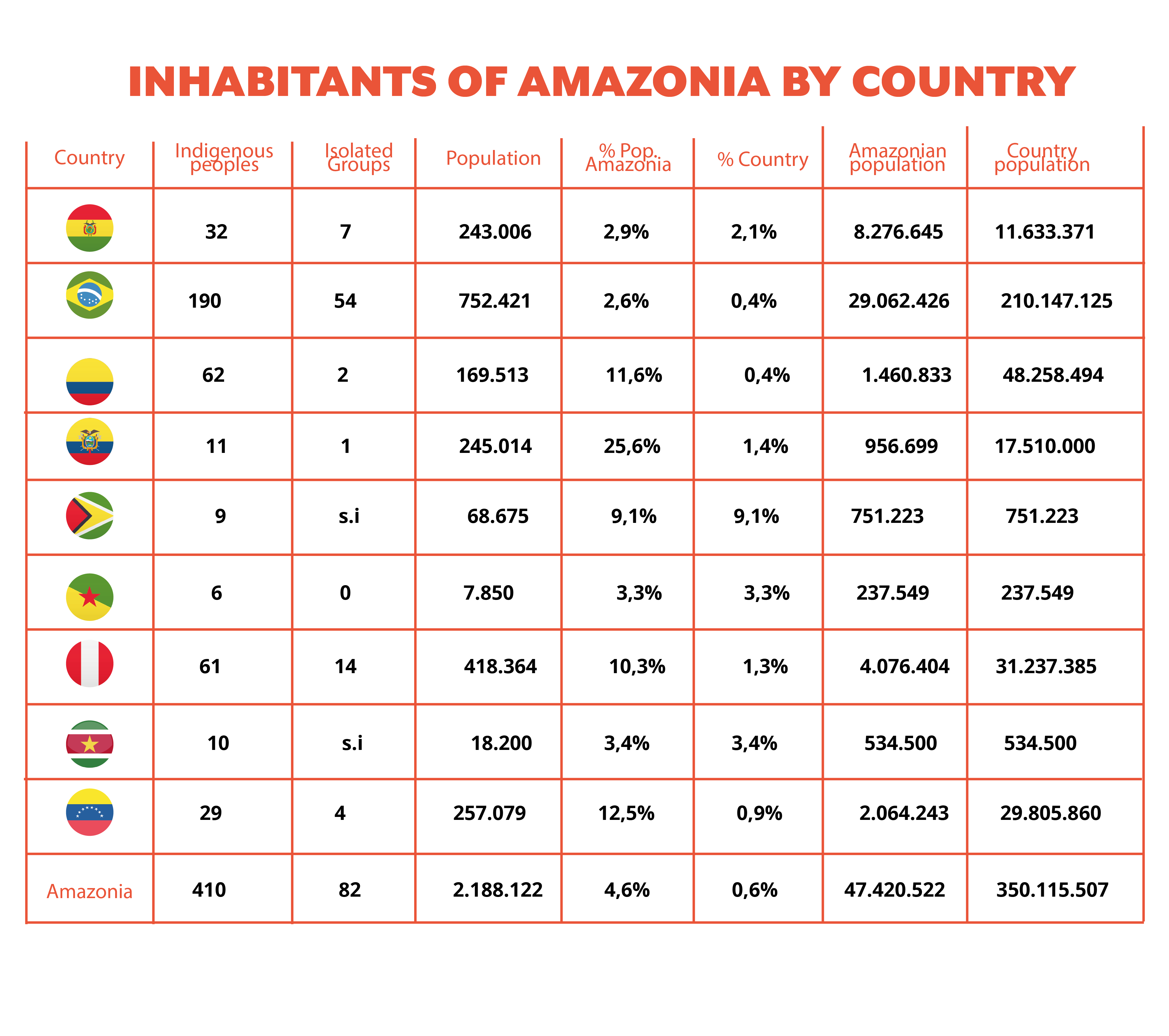
To understand why this diversity of life and landscapes continues to be conserved, we need to recognize the role of indigenous peoples in the protection of their territories through their traditions and customs. Indigenous territories currently occupy 27.5% of Amazonia, that is 2.3 million km². There are 410 indigenous groups living here, of which 82 are in voluntary isolation and have not been contacted by other peoples or societies.
Also, 33.5 million people are Amazonian, of whom 62.8%, equivalent to 20.9 million people, live in urban areas.
Also, 33.5 million people are Amazonian, of whom 62.8%, equivalent to 20.9 million people, live in urban areas.
Amazonia has a close relationship between urban areas and economic activities whether agricultural or extractive. For example, once roads have improved, access to natural resources is inevitable facilitating the exploitation of forest.